Kilometer-long hike to the highest peak of the Majella, Monte Amaro (2793 m).
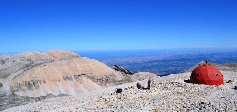
From the roof you can see Majella 2/3 Abruzzo. By the Dolomite peaks of the Gran Sasso to the Monte Velino chain, from the Abruzzo National Park to the beautiful Costa Trabocchi. On clear days you can even admire the Tremiti Islands, beautiful archipelago of small islands in front of the Gargano promontory in Apulia.
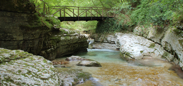
Unique excursion for variety of environments, the lush forests of beech with colorful alpine meadows and magnificent shrubs in mountain pine, wreck of the Quaternary glaciations, imposing scree and moraine amphitheaters where fossils and extraordinary endemic plants will be witness to such a hostile environment as extraordinary.
We propose three itineraries: two of the most beautiful ways to reach Mount Amaro and a crossing.
ITINERARY 1 (refuge Pomilio – Monte Amaro)
The first proposed route starts from an altitude 1800 m in località Blockhaus, It is the way that provides the lowest altitude to reach the summit. On the return route it is also expected to climb to the Cima Murelle, one of the characteristics of the entire Majella peaks.
Day 1:
From Refuge Pomilio (1800 m) – the top of Mount Amaro (2793 m)
Travel time: 4:30/5 ore (excluding stops)
overnight stay: bivouac Pelino (2775 m)
Day 2:
bivouac Pelino (2775 m) – Cima Murelle (2596 m) – refuge Pomilio (1800 m)
Travel time: 6 ore (excluding stops)
ITINERARY 2 (Fara San Martino – Monte Amaro)
The second proposal involves starting from the beautiful village of Fara San Martino, home of Abruzzo pasta (De Cecco and Del Verde) and the starting point of one of the most beautiful valleys of Italy, Gorges of Fara San Martino. It is one of the longest mountain valleys absolute (circa 12 Km) Fara that leads to the foot of Mount Amaro. E’ the steepest path to the summit (2350 m one way) but also the most impressive.
Day 1:
Fara San Martino (450 m) – Monte Amaro (2793 m)
Travel time: 6/7 ore (excluding stops)
overnight stay: bivouac Pelino (2775 m ) or Rifugio Manzini (2550 m)
Day 2:
Bivouac Pelino or Manzini – Fara San Martino
Travel time: 5:30/6 ore (excluding stops)
ITINERARY 3 (Crossing Majella)
This route leads southeast – Northwest the entire massif of Majella. Extremely varied route, cross deep gorges with walls hundreds of meters, lush forests of beech trees, deep valleys crossed by clear rivers without forgetting the great and bitter typical alpine plateaus of the high streets of Majella.
The initiative involves the use of a minbus as a place of departure and arrival are different and far.
Day 1:
Fara San Martino (450 m) – Monte Amaro (2793 m)
Travel time: 6/7 ore (excluding stops)
overnight stay: bivouac pelino (2775 m)
Day 2:
Monte Amaro (2793 m) – Monte Pescofalcone (2657 m) – Valle Orfento (1000 m) – Caramanico Terme (600 m)
Travel time: 6/7 ore (excluding stops)
Tours are suitable only for people with a good basic training.