The Way of St. Thomas
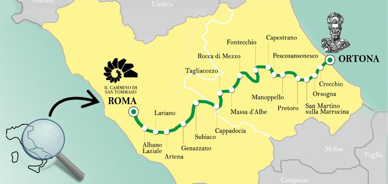
The Way of St. Thomas is a cultural itinerary, natural and spiritual which connects the town of Ortona, keeper of the Apostle's remains since 1258, in Rome with St. Peter's Basilica. A long journey of about 313 km through the most genuine heart of enhancing the landscape excellences,the places of worship such as churches, hermitages and abbeys, silent guardians of spirituality and some of the best preserved villages of the two regions of Lazio and Abruzzo.
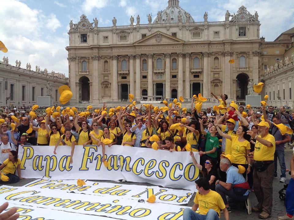
The Way is also a form of modern pilgrimage, we like to call "pellegriviaggio", in the footsteps of Saint Brigida di Svezia that, between 1365 and the 1368, He came to Ortona following the revelation of the presence of the bones of St. Thomas in the city's cathedral.
History provides a starting point to discover, with modern forms, the activities of travel, as it happened in Santiago de Compostela, the model of which was taken as an example by the Way of St. Thomas to join Lazio and Abruzzo.
Walking the traveler can discover, through spectacular paths, ancient mule tracks and stretches of farm road, some of the most important natural parks of central Italy: the Regional Natural Park of the Castelli Romani, the Regional Natural Park of Monti Simbruini, the Regional Natural Park Sirente – Velino, Gran Sasso National Park and Monti della Laga and the Majella National Park, as well as several small Nature Reserves.
You can discover important places of worship, medieval abbeys, castelli, extraordinary examples of art and culture that for centuries are kept by local people.
With small stops along the way the traveler can also enjoy the picturesque villages of Lazio: Subiaco, Genazzano, Olevano Romano, Albano Laziale, Roiate etc.; and those Abruzzese: tagliacozzo, Scurcola Marsicana, durmast, Fontecchio, Bominaco, Caporciano, Navelli, Capestrano, Pescosansonesco, Pretoro, San Martino alla Marrucina and many others
The Stages of the Path
Ithe route of the "Way of St. Thomas" has been conceived and designed by the Environmental Guide Massari Alessio, Vice President of our Routes Association of Abruzzo, I agree with the’Association The Way of St. Thomas He chose to cross the Apennines, from Rome to the Adriatic, with a path that unites faith and nature, culture and tradition.
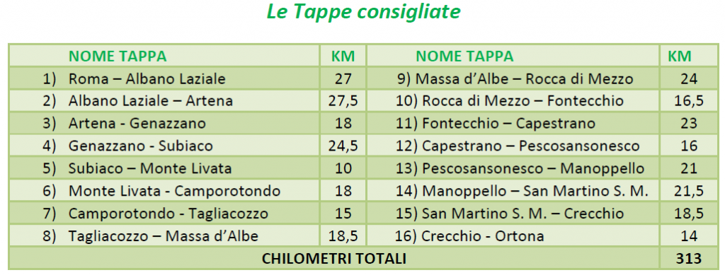
E 'on foot in 16 days, Following are the recommended stops:
How to get in the way
The Way of St. Thomas is a very young itinerary, just five years, why not infrastructured in terms of services and signage as the most famous cousins.
Our association provides pre-built Environmental Excursion Guide groups that directly participated in the creation of the Way of St. Thomas. For questions please contact us from the special section Contacts site.
To allow instead for travelers / pilgrims to walk independently the Way, The Association of the Way of St. Thomas He devised the package Pellegrino which comprises:
- Way of the entire GPS Track
- Manual with all the tips step by step on the itinerary
- The list of some hotels (overnight stay and breakfast 20 €)
- The Charter of Pellegrino where to affix the stamps at the end of each stage
- A secular or religious certificate issued on request if it is covered at least the stretch Manoppello – Ortona, or Roma – Subiaco.
To apply for the package pilgrim visit the appropriate page on the website of where the method is indicated. Here's the direct link: